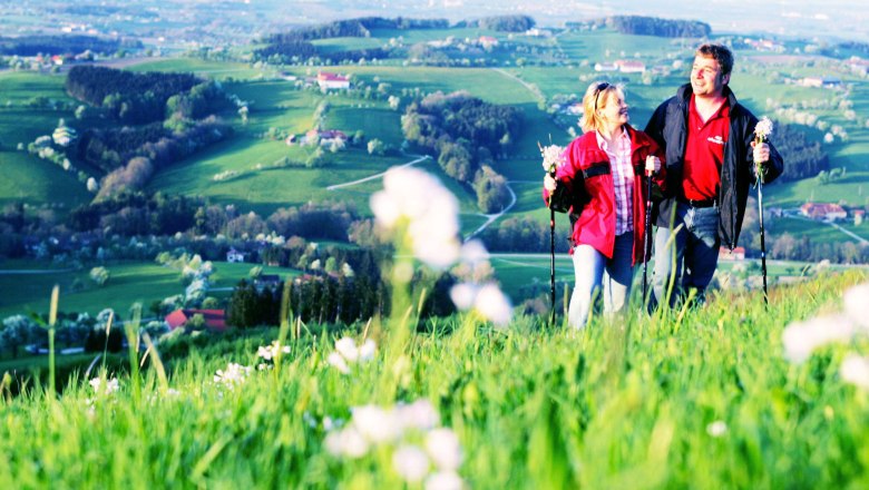
Hiking along the Moststraße (Perry Road)
You can choose from any number of hiking and educational trails to explore the land of perry pear trees in the Mostviertel in Lower Austria.
What all these Perry Road paths and trails have in common is the enchanting countryside through which they take you. You pass stately quadrangular farmsteads and vast meadows sprinkled with gnarled pear trees. These hikes are particularly impressive in April and May when the pear trees are in bloom.
Scenic Hiking Trai in Alpine Foothills
(Wanderweg Voralpenblick)
The 11.4 kilometer long trail leads to a view of the Alpine foothills from an observatory to the Heuras family's vineyard and then to St. Michael/Bruckbach, the Fehringer vineyard, and along the Urlbach (river) back to Ertl.
Difficulty: easy
Distance: 11.4 km
Ascent: 427 m
Descent: 425 m
Duration: 3 h
Lowest point: 415 m
Highest point: 720 m
Hochkogel Panorama Trail
(Hochkogel-Panoramaweg)
The 19.9 kilometer long circular trail leads from Euratsfeld onto the Hochkogel and back to Euratsfeld. The Hochkogel is 700 meters high and affords a beautiful view of the Mostviertel.
The trail begins and ends in Euratsfeld.
Difficulty: moderate
Distance: 19.9 km
Ascent: 598 m
Descent: 598 m
Duration: 5 h
Lowest point: 279 m
Highest point: 645 m
Panorama View (Perry Fruit Hiking Trail)
(Panoramablick (Mostobstwanderweg))
The 7.3 kilometer long circular route through Blümelsberg and back to Seitenstetten Abbey provides a beautiful view of Seitenstetten and the surrounding communities.
Difficulty: easy
Distance: 7.3 km
Ascent: 203 m
Descent: 204 m
Duration: 2 h
Lowest point: 340 m
Highest point: 513 m
